From Camera Traps
to Foundation Models
A global field guide to the smartest things happening in conservation technology — what works, what's next, and why it matters
Wildlife conservation is no longer short of sensors. Camera traps, acoustic recorders, satellite tags, drones, Earth observation satellites, electronic monitoring systems on fishing vessels, eDNA samplers, and citizen science apps are producing more biodiversity data than humans can review by hand. The bottleneck has shifted from collecting observations to turning observations into decisions.
That is where artificial intelligence is becoming genuinely useful. The best work in AI for wildlife is not about replacing ecologists, rangers, taxonomists, or local knowledge holders. It is about helping them move faster: filtering millions of empty camera-trap frames, detecting animals in real time, matching an individual whale or zebra across years of photographs, listening for rare birds in thousands of hours of audio, mapping habitats from satellites, and flagging vessel behaviour that would otherwise remain invisible.
This post is a global snapshot of the field in 2026: what is mature, what is experimental, what is genuinely exciting, and what still needs caution. The short version is simple: AI is becoming the connective tissue between wildlife sensors and conservation action.
Source note: This post was researched from official project documentation, peer-reviewed papers and preprints, conservation-technology organisations, Google Research, Microsoft AI for Good, Conservation X Labs/Wild Me, Cornell/BirdNET, Earth Species Project, Project CETI, Global Fishing Watch, EarthRanger, SMART, The Nature Conservancy, NASA/IBM, Google DeepMind, and recent AI-for-conservation literature. Sources are linked throughout and listed again at the end.
The Big Picture
The field is moving through three waves.
| Wave | What changed | Typical tools | What it enables |
|---|---|---|---|
| Wave 1: automation | AI sorts and labels data humans already collected. | MegaDetector, SpeciesNet, BirdNET, Wildlife Insights, Wildbook. | Millions of images and recordings become usable without years of manual review. |
| Wave 2: real-time sensing | AI moves from the lab or cloud to the field edge. | TrailGuard AI, WPS cameras, SPARROW, cellular camera traps, on-board fisheries AI. | Rangers and managers can respond while the event is still happening. |
| Wave 3: foundation models | Large reusable models learn general representations of species, sounds, video, or landscapes. | BioCLIP, NatureLM-audio, AlphaEarth Foundations, Prithvi, SAM/SA-FARI. | Small local datasets can be connected to global models, making new projects cheaper to start. |
The most important shift is that AI is becoming less of a one-off research model and more of an operational layer: a set of practical services that help conservation teams monitor populations, understand threats, and justify decisions with evidence.

Where AI Is Already Useful
Some parts of the field are already operational. Others are still research-heavy. A realistic state-of-the-field map looks like this:
| Area | Current maturity | What AI does well | Main caution |
|---|---|---|---|
| Camera-trap filtering | Operational | Finds animals, people, vehicles; removes blank images; speeds up review. | Species ID still needs local validation. |
| Camera-trap species classification | Operational but uneven | Labels common species across many regions. | Rare, cryptic, nocturnal, juvenile, and out-of-distribution species remain hard. |
| Individual animal re-identification | Operational for patterned species | Matches whales, sharks, zebras, giraffes, leopards, turtles and other visually distinctive individuals. | Requires good image quality, consistent matching workflows, and expert review. |
| Bioacoustic species detection | Operational for birds and some taxa | Detects calls in huge sound archives; helps build soundscape indicators. | Background noise, overlapping calls, geography, and behaviour context matter. |
| Animal communication AI | Early but exciting | Finds structure in whale, dolphin, bird, and other animal vocalisations. | “Translation” claims should be treated carefully. |
| Drones and aerial surveys | Growing | Counts large animals, detects thermal signatures, surveys dangerous or remote places. | Regulation, disturbance, battery life, and false detections are major constraints. |
| Anti-poaching and ranger support | Operational in selected sites | Predicts risk, routes patrols, sends alerts, integrates field observations. | Data bias and ranger safety must be central. |
| Fisheries and ocean transparency | Operational and expanding | Classifies vessel behaviour, detects dark fleets, reviews electronic-monitoring footage. | AIS manipulation, jurisdiction, and enforcement capacity remain hard. |
| Satellite habitat modelling | Operational | Maps land cover, habitat condition, deforestation, fragmentation, water, fire, and change. | Remote sensing sees habitat proxies, not always animals directly. |
| Multimodal biodiversity intelligence | Emerging | Combines camera traps, audio, drones, GPS collars, satellites, eDNA, and field records. | Standards, data governance, privacy, and interoperability are the bottleneck. |
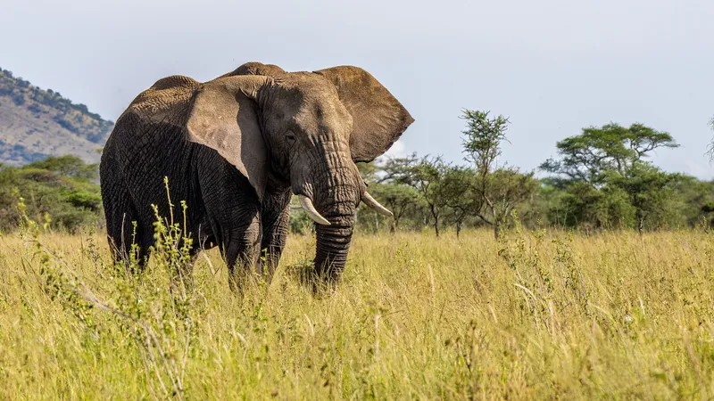
1. Camera Traps: The Workhorse of Wildlife AI
Camera traps are probably the most mature area of AI in wildlife. They are cheap enough to deploy widely, passive enough to monitor elusive animals, and productive enough to create a data avalanche. The challenge is that a single deployment can produce hundreds of thousands or millions of images, many of them empty.
MegaDetector, built by Microsoft’s AI for Good Lab, is one of the most important practical tools in this space. It does not try to identify every species. It detects animals, people and vehicles in camera-trap imagery, draws bounding boxes, and assigns confidence scores. That simple job is incredibly useful: it removes blanks, flags human activity, and gives downstream species models a cleaner set of images to analyse.
Source:
MegaDetector documentation
.
SpeciesNet, developed by Google and originally served through Wildlife Insights, is the next layer up: a camera-trap species classifier. Google describes the open-source SpeciesNet model as classifying nearly 2,500 mammal, bird and reptile categories, trained from 65 million labelled camera-trap images contributed by conservation partners. It works alongside MegaDetector: first find the animal, then classify the animal.
Source:
Google Research SpeciesNet post
;
SpeciesNet GitHub repository
.
Wildlife Insights is the platform story around this. It is a cloud platform for managing, analysing and sharing camera-trap data, with machine-learning tools built into the workflow. For many conservation teams, that matters more than the model itself. A great model is not useful if teams cannot upload data, manage metadata, review predictions, export records, and cite datasets.
Source:
Wildlife Insights
.
PyTorch-Wildlife is part of the open tooling layer. It wraps wildlife detection and classification models into a more accessible PyTorch framework and model zoo, with documented use cases including Amazon rainforest species recognition and invasive opossum recognition in the Galápagos. This is important because conservation AI should not only live inside closed platforms.
Source:
PyTorch-Wildlife paper
;
PyTorch-Wildlife documentation
.
Why this is cool
Camera-trap AI turns years of image review into days or weeks. It lets conservation teams ask bigger questions: not only “what species did we see?” but “how are animals using this corridor?”, “has activity shifted after fire?”, “are predators avoiding people?”, “are invasive species increasing?”, and “where should the next patrol or restoration effort go?”.
What still goes wrong
Camera-trap AI is not magic. Models can fail when the camera angle, region, vegetation, night illumination, animal age, animal posture, or species mix differs from the training data. Recent research has shown that training data quality and size can affect downstream ecological metrics, not just prediction accuracy. In other words: a model can look good in machine-learning terms and still bias an ecological conclusion if the validation is weak.
Source:
training data quality and ecological metrics paper
.
2. From Global Models to Local Wildlife Intelligence
The most interesting pattern in camera-trap AI is the movement from one global model to many locally adapted workflows. A global model like SpeciesNet or MegaDetector gives a project a strong starting point. But local teams still need to tune thresholds, add missing species, review uncertain predictions, and keep a human-in-the-loop pipeline.
This is where the “smart people” are doing some of their best work: not just building bigger models, but designing practical review systems, regional models, active-learning loops, and workflows for non-technical ecologists.
| Approach | Example | Why it matters |
|---|---|---|
| Global detector | MegaDetector | Useful almost everywhere because animal/person/vehicle detection generalises better than species ID. |
| Global species classifier | SpeciesNet | Gives many projects a strong first pass across thousands of taxa. |
| Local or regional species model | UK mammal/bird models, African savanna models, Galápagos invasive-species models. | Improves performance where global models miss local fauna or confuse similar species. |
| Review UI and data platform | Wildlife Insights, Agouti, Camelot, TRAPPER, WildTrax, custom dashboards. | Turns predictions into auditable ecological records. |
| Active learning | Retrain on local mistakes and uncertain cases. | Reduces labelling burden while improving project-specific accuracy. |
A good 2026 wildlife AI workflow is rarely “upload images and trust the model.” It is more like: detect animals, classify likely species, prioritise uncertain cases for review, export validated records, protect sensitive locations, and report uncertainty.
- Video, Tracking and Segmentation: From Still Images to Behaviour
Still-image classification is useful, but ecology often needs movement and behaviour. Is that elephant feeding, walking, drinking, limping or interacting? Did the same leopard pass twice? Are multiple animals moving as a group? This is where video analysis, segmentation and multi-animal tracking become important.
The SA-FARI dataset, released by Conservation X Labs and Meta collaborators, is a major step in this direction. It stands for
Segment Anything in Footage of Animals for Recognition and Identification
. The dataset contains 11,609 camera-trap videos from 741 locations across four continents, spanning 99 species categories, with dense annotations for multi-animal tracking, segmentation masks, boxes and species labels.
Source:
SA-FARI paper
;
SA-FARI project page
.
This connects to a broader shift in computer vision: promptable segmentation models such as Segment Anything and its successors are making it easier to outline animals, track them through frames, and build training data for species and behaviour tasks. The conservation value is not just a cleaner mask. It is the possibility of measuring body condition, group size, movement paths, interaction rates and habitat use at much finer temporal resolution.
What to watch
The next frontier is not only “which species is this?” It is “what is happening in the scene?” That means behaviour recognition, animal tracking through time, scene context, and eventually ecological summarisation. Some research is already combining object detectors with vision-language models to generate richer reports from camera-trap data, but this should be treated as decision support, not as ecological truth.
Source:
context-rich automated biodiversity assessment paper
.
4. Individual Animal ID: Turning Photos into Population Science
One of the most powerful uses of AI in wildlife is individual re-identification. Instead of only asking “how many zebra photos do we have?”, individual ID asks “which zebra is this, and where else has it been seen?” That unlocks mark-recapture analysis, survival estimates, social networks, migration routes and population trends.
Wildbook, from Wild Me / Conservation X Labs, is the flagship example. It is an open-source software framework for mark-recapture, molecular ecology and social ecology studies. Wildbook uses computer vision and machine learning to locate animals, identify species and suggest individual matches inside a database. Conservation X Labs states that Wildbook supports more than 250 species and more than 1.4 million sightings worldwide.
Source:
Wildbook
;
Wild Me Wildbook overview
;
Conservation X Labs Wild Me Lab
.
This is especially useful for animals with natural markings: whale flukes, whale shark spots, zebra stripes, giraffe coat patterns, leopard rosettes, manta ray markings, turtle faces, seal scars and more. The AI does not “know” an animal personally. It compares visual features and proposes candidate matches. Human experts still review those matches.
Why this matters
Individual ID is where AI becomes population monitoring rather than just image labelling. It can turn tourist photos, researcher images and camera-trap records into long-term histories of living animals. That is scientifically powerful and emotionally powerful: every datapoint can become a known individual with a life history.
5. Bioacoustics: Listening to the Planet at Scale
If camera traps are the eyes of AI conservation, bioacoustics is its hearing. Audio recorders can run for months, operate at night, cover dense forests where cameras see little, and detect species that are vocal but rarely photographed. The challenge is that one small recorder can produce thousands of hours of audio.
BirdNET, from the Cornell Lab of Ornithology and Chemnitz University of Technology, is one of the most visible success stories. It uses AI to identify bird species from sound and has become both a public app and a scientific tool. The official BirdNET project frames it as AI-powered sound ID for citizen scientists and bioacoustic research.
Source:
BirdNET
.
Arbimon, developed by Rainforest Connection, is another important platform. It helps researchers upload, store and analyse large acoustic datasets, including species-specific and multi-species models. This kind of infrastructure matters because bioacoustics needs more than a recogniser: it needs long-term storage, site management, time-of-day analysis, soundscape metrics and repeatable workflows.
Source:
Arbimon
;
Rainforest Connection ecoacoustics
.
NatureLM-audio, from Earth Species Project, points to the next phase: foundation models for bioacoustics. Rather than training a narrow detector for one species, NatureLM-audio is designed for flexible bioacoustic tasks such as species classification, detection and captioning. Earth Species Project describes it as the first large audio-language model tailored specifically for animal sounds.
Source:
Earth Species Project NatureLM-audio announcement
;
NatureLM-audio on Hugging Face
.
Why this is cool
Bioacoustics can turn forests, reefs, wetlands and farms into measurable soundscapes. It can reveal when birds return after restoration, whether frogs are breeding, whether gunshots or chainsaws are present, and how human noise changes animal behaviour.
What still goes wrong
Audio is messy. Wind, rain, insects, vehicles, overlapping calls and unknown species can fool models. Bioacoustic AI should usually be treated as a detection-assistance system unless the project has local validation data.
- Animal Communication: The Most Sci-Fi Part, but Also the Easiest to
Overhype
Some of the most fascinating work is happening at the boundary between bioacoustics, linguistics, machine learning and animal behaviour. The question is no longer only “which species made this sound?” but “what structure exists in the communication system?”
Project CETI is applying machine learning, robotics and field biology to sperm whale communication, especially in Dominica. Their goal is to listen to, model and eventually better understand sperm whale codas: patterned sequences of clicks used in social communication.
Source:
Project CETI
.
DolphinGemma, announced by Google in collaboration with the Wild Dolphin Project and Georgia Tech, is a large language model trained on dolphin audio to help scientists study dolphin communication. Google describes it as a model that can help learn the structure of dolphin vocalisations and generate dolphin-like sound sequences for research.
Source:
DolphinGemma model page
;
Google DolphinGemma blog
.
This work is genuinely exciting. But it needs careful language. AI can find statistical structure, cluster call types, model sequences and suggest hypotheses. That is not the same as “translating whale language into English.” The best scientists in this space are careful because meaning requires behavioural context, social context, field experiments and ethics.
7. Drones, Aircraft and Aerial AI
Aerial surveys are expensive, dangerous and slow when done manually. AI is helping turn drone, aircraft and thermal imagery into animal counts, nest detections, carcass detections, anti-poaching intelligence and habitat assessments.
SCOUT, from Wild Me / Conservation X Labs, is an open hardware and open-source software solution for aerial surveys of wildlife and forests. It is designed to support analysis of large volumes of imagery from aerial surveys, making wildlife population assessments cheaper, safer and more accurate.
Source:
SCOUT
.
A 2025 review of drones and AI-driven solutions for wildlife monitoring describes applications across species identification, animal tracking, movement analysis, anti-poaching, population estimation and habitat assessment. The pattern is clear: drones expand the observation area, and AI reduces the image-analysis bottleneck.
Source:
Drones and AI-driven wildlife monitoring review
.
Where it shines
Drones are especially useful for open landscapes, wetlands, seabird colonies, large mammals, thermal detection, marine megafauna, nest monitoring and inaccessible terrain.
Where it struggles
Dense canopy, weather, flight permissions, battery life, animal disturbance and small species detection remain practical constraints. Aerial AI also needs careful ground-truthing: a false count can mislead management.
8. Edge AI: Moving Intelligence into the Field
Most early wildlife AI worked after the field campaign: collect SD cards, drive back, upload data, run models. Edge AI changes the timing. It puts inference on or near the sensor, so a camera or recorder can decide what matters before sending data.
SPARROW, from Microsoft’s AI for Good Lab, stands for Solar-Powered Acoustic and Remote Recording Observation Watch. Microsoft describes it as an AI-powered edge computing solution designed to work autonomously in remote places, collecting camera-trap, acoustic and environmental data and processing it with wildlife AI models on power-efficient edge GPUs.
Source:
Microsoft SPARROW announcement
;
SPARROW GitHub repository
.
TrailGuard AI and Wildlife Protection Solutions show the anti-poaching and real-time alerting side. TrailGuard uses small concealed cameras with onboard AI to detect humans, wildlife or vehicles and transmit relevant images. WPS describes AI-enabled camera systems for continuous real-time monitoring of protected areas.
Sources:
RESOLVE TrailGuard AI
;
Wildlife Protection Solutions
.
A 2026 review of edge AI in biodiversity monitoring found growing research across acoustic, vision, tracking and multimodal systems, while also highlighting fragmented adoption and trade-offs among power consumption, compute, communication and ecological inference.
Source:
Future of Edge AI in biodiversity monitoring review
.
Why edge AI matters
In conservation, timing matters. A poacher alert three weeks later is an archive. A cattle-lion conflict alert the next morning may be too late. Edge AI is exciting because it can move wildlife monitoring from retrospective reporting toward response.
9. Protected Area Platforms: From Data Points to Decisions
AI models are not enough. Rangers and conservation managers need systems that combine observations, patrols, incidents, GPS collars, camera traps, vehicles, alerts, maps and reports. This is where protected-area platforms become central.
EarthRanger, developed by Vulcan and now associated with Allen Institute for AI/Ai2 support, is a software platform for real-time conservation operations, ecosystem monitoring and protected area management. It helps managers integrate data streams and make operational decisions.
Source:
EarthRanger
;
EarthRanger Methods in Ecology and Evolution paper
.
SMART, the Spatial Monitoring and Reporting Tool, is an open-source, non-proprietary conservation tool suite for collecting, storing, communicating and evaluating data on wildlife and conservation areas. It is widely used by rangers and protected area teams.
Source:
SMART Conservation Tools
.
PAWS, the Protection Assistant for Wildlife Security, is one of the best-known examples of AI for patrol planning. The research uses machine learning, uncertainty modelling and game-theoretic ideas to identify poaching risk and plan patrol routes under limited resources. Field-test papers report improved detection of snares in some settings, but the most important lesson is that AI must be embedded in ranger knowledge, field constraints and safety.
Source:
PAWS field-test paper
;
PAWS remote-sensing enhancement paper
.
10. Ocean AI: Fishing, Whales and the Invisible Sea
The ocean is hard to monitor because it is vast, mobile, legally complex and often hidden from public view. AI is starting to make it more visible.
Global Fishing Watch uses vessel tracking, satellite data and machine learning to classify vessel behaviour and make fishing activity more transparent. Their technology page describes models for vessel classification and fishing activity, while a 2024 study used machine learning and satellite imagery to reveal large amounts of industrial vessel traffic and offshore infrastructure not visible in public monitoring systems.
Source:
Global Fishing Watch technology
;
2024 global ocean activity study release
.
The Nature Conservancy is working on edge AI for electronic monitoring in fisheries. Instead of reviewing months of vessel video footage after a fishing trip, onboard AI can flag fishing events, target catch and bycatch for faster human verification.
Source:
The Nature Conservancy AI monitoring in industrial fishing
.
Whale Safe, from the Benioff Ocean Science Laboratory at UC Santa Barbara, is an AI-powered whale detection and ship-risk system. It integrates acoustic detections, visual sightings, habitat model predictions and ship data to provide near-real-time whale and ship information in busy shipping regions.
Source:
Whale Safe
.
Why this matters
The ocean has historically been under-observed. AI does not solve governance, but it changes the evidence base. It makes illegal, unreported and unregulated fishing harder to hide. It makes whale presence more visible to shipping operators. It makes bycatch monitoring less dependent on slow manual review.
11. Satellite AI: Habitat, Pressure and Planetary Context
Wildlife does not exist without habitat. That is why Earth observation AI belongs in the wildlife conversation. Satellites do not usually identify individual animals, but they can map the habitat conditions that determine whether species can survive: forest loss, grassland condition, water availability, fire scars, agriculture, roads, settlements, coastlines and climate stress.
AlphaEarth Foundations, announced by Google DeepMind in July 2025, is a geospatial foundation model that integrates large volumes of Earth observation data into reusable representations. The practical output in Earth Engine is the Google Satellite Embedding dataset: annual 10 m, 64-dimensional embeddings designed for clustering, classification, similarity search and change detection.
Source:
Google DeepMind AlphaEarth Foundations
;
Google Satellite Embedding Earth Engine dataset
.
Prithvi, the NASA-IBM geospatial foundation model family, is another key example. NASA describes Prithvi as an open-source geospatial foundation model developed with IBM Research and the Jülich Supercomputing Centre, with applications across Earth observation tasks.
Source:
NASA Prithvi applications
;
IBM-NASA geospatial models on Hugging Face
.
For wildlife teams, geospatial foundation models matter because they reduce the need to start from raw satellite bands every time. A conservation scientist with a small number of field plots, animal locations or habitat labels can use pretrained embeddings to build maps faster.
The key caution
Satellite AI maps habitat, not certainty. A “suitable habitat” map is a hypothesis. It needs field data, species knowledge and local validation.
12. Citizen Science: Millions of People as Sensors
AI in wildlife is not only for researchers with grants. Citizen science platforms are turning public observations into massive biodiversity datasets, and AI is making participation easier.
iNaturalist is the obvious example. Its computer-vision system suggests identifications from user-uploaded photos, while the community helps confirm observations. iNaturalist’s help documentation explains how taxa are included in computer-vision training, and a 2025 update noted that the model grows as new taxa meet photo and observation thresholds.
Source:
iNaturalist computer vision taxa guidance
;
iNaturalist 2025 model update
.
Citizen science data also trains broader models. The original iNaturalist computer-vision dataset helped expose the difficulty of fine-grained species classification: natural-world datasets are imbalanced, long-tailed and filled with visually similar species.
Source:
iNaturalist Species Classification and Detection Dataset paper
.
The broader lesson is that AI and citizen science are a powerful loop: people produce observations, AI lowers the barrier to participation, experts and communities validate, and validated records improve future models.
- Biological Foundation Models: AI That Understands the Tree of Life
A major shift is the rise of models trained not for one species or one reserve, but for broad biological representation.
BioCLIP is a vision foundation model for the tree of life. It was trained using biological images and taxonomic structure to perform general organismal image tasks across animals, plants and fungi. Microsoft Research describes BioCLIP as leveraging the TreeOfLife-10M dataset, while the paper reports strong zero-shot and few-shot performance improvements over general-purpose CLIP-style baselines.
Source:
Microsoft Research BioCLIP
;
BioCLIP project page
.
BioCLIP 2 pushes this further with a much larger TreeOfLife-200M dataset and explores emergent biological structure in the embedding space, including ecological and trait-related information.
Source:
BioCLIP 2 paper
.
These models matter because wildlife science is long-tailed. There are many rare species, many local contexts and many datasets with only a few labels. Foundation models can make few-shot and transfer-learning workflows more practical.
What they do not solve
A foundation model is not a taxonomist. It may know visual similarity but not local field context, subspecies boundaries, hybridisation, age/sex classes, cryptic species, or the political sensitivity of a location record.
14. eDNA and AI: The Invisible Biodiversity Layer
Environmental DNA, or eDNA, detects genetic material that organisms shed into water, soil, air or sediment. It is not always framed as “wildlife AI,” but it increasingly belongs in the same monitoring stack. Machine learning can help interpret high-dimensional sequence data, identify species, detect invasive or rare taxa, and combine eDNA with GIS and remote sensing.
Recent reviews describe eDNA as a sensitive, efficient and non-invasive biodiversity-monitoring tool, while newer AI-GIS-eDNA frameworks are being proposed for real-time freshwater health assessment and broader ecosystem monitoring.
Sources:
2025 eDNA biodiversity monitoring review
;
AI-GIS-eDNA framework review
.
The exciting idea is that AI could eventually combine visible evidence from cameras, audible evidence from recorders, molecular evidence from eDNA, and landscape evidence from satellites. That is a much richer picture of biodiversity than any one sensor can provide.
15. Movement, Collars and Behaviour Recognition
Animal-borne sensors are becoming another AI frontier. GPS collars, satellite tags, accelerometers and other biologgers can record where animals move, how fast they move, and sometimes what they are doing.
Movebank, hosted by the Max Planck Institute of Animal Behavior, is a major data infrastructure for animal tracking. It helps researchers manage, share, protect, analyse and archive animal tracking and sensor data.
Source:
Movebank
.
Machine learning is increasingly used to classify animal behaviour from accelerometer data. The Bio-logger Ethogram Benchmark, for example, provides datasets and evaluation tasks for computational analysis of animal behaviour using animal-borne tags.
Source:
Bio-logger Ethogram Benchmark paper
.
For wildlife managers, this can mean detecting migration changes, identifying risky conflict zones, monitoring energy expenditure, or understanding when animals feed, rest, flee or reproduce. But as with camera traps, behaviour labels need careful validation.
A Global Map of What Is Happening
This is not a complete list of every project, but it shows the breadth of the field.
| Region / domain | Examples | What is happening |
|---|---|---|
| Africa | EarthRanger, PAWS, Wildbook, SpeciesNet, MegaDetector, Wildlife Insights, TrailGuard AI, CXL/Wild Me. | Large-mammal monitoring, protected-area operations, endangered species ID, poaching risk, real-time alerts, aerial surveys. |
| Asia | SMART, PAWS, camera-trap AI, tiger/leopard conflict systems, acoustic and satellite monitoring. | Protected area management, conflict alerts, tiger monitoring, patrol planning, illegal activity detection. |
| Europe and UK | BirdNET, UK mammal models, Conservation AI / Trap Tracker, bioacoustic monitoring, eDNA surveys. | Open regional models, farmland and woodland monitoring, acoustic bird surveys, restoration tracking. |
| North America | iNaturalist, BioCLIP, Wildlife Insights, Whale Safe, Project CETI collaborators, Movebank, AI for Good Lab. | Citizen science, foundation models, whale-ship collision risk, animal communication, tracking-data infrastructure. |
| Latin America | Rainforest Connection / Arbimon, SpeciesNet, Wildlife Insights, AlphaEarth, Global Fishing Watch. | Rainforest soundscapes, camera-trap networks, forest and habitat mapping, illegal fishing transparency. |
| Oceania | Wildlife.ai, WildObs, drone thermal surveys, SpeciesNet local adaptation. | Marine reserve monitoring, invasive species, rare species ID, thermal drone detection. |
| Open ocean | Global Fishing Watch, TNC edge monitoring, Whale Safe, DolphinGemma, Project CETI. | Fishing transparency, bycatch monitoring, whale detections, animal communication, ship-strike mitigation. |
| Planetary habitat layer | AlphaEarth Foundations, Prithvi, Google Earth Engine, Dynamic World, Global Forest Watch. | Habitat mapping, change detection, restoration monitoring, climate and land-use context for species data. |
The Emerging Wildlife AI Stack
The future will not be one magical model. It will be a stack of tools that work together.
| Layer | Examples | Role |
|---|---|---|
| Sensors | Camera traps, microphones, drones, collars, satellites, eDNA samplers, vessel cameras. | Collect observations. |
| Edge intelligence | SPARROW, TrailGuard AI, WPS, onboard fisheries AI. | Filter and alert in the field. |
| Foundation models | BioCLIP, NatureLM-audio, AlphaEarth, Prithvi, SAM-style segmentation models. | Provide reusable features across tasks. |
| Task models | MegaDetector, SpeciesNet, BirdNET, local YOLO models, Wildbook matchers. | Detect, classify, match, count or segment. |
| Data platforms | Wildlife Insights, Wildbook, Arbimon, EarthRanger, SMART, Movebank, GBIF. | Manage records, metadata, review and sharing. |
| Human validation | Field rangers, ecologists, taxonomists, local experts, Indigenous and community knowledge holders. | Check predictions and interpret context. |
| Decision layer | Protected-area plans, patrol routes, restoration priorities, species recovery actions, policy evidence. | Turn observations into conservation action. |
The best teams are not asking “which AI model should we use?” They are asking: “What decision are we trying to improve, what data do we need, what uncertainty is acceptable, who reviews the output, and how will it change action on the ground?”
The Hard Parts: What AI Still Cannot Fix
AI makes wildlife monitoring faster, but the hard conservation problems remain social, political, ecological and ethical.
1. Bias in biodiversity data
Biodiversity datasets are deeply uneven. Charismatic mammals, accessible places, wealthy institutions and well-studied regions are overrepresented. Small animals, nocturnal species, insects, cryptic taxa and underfunded regions are underrepresented. Models inherit this imbalance.
2. False confidence
A labelled spreadsheet can look official even when the model is wrong. Field teams need confidence thresholds, review queues, uncertainty flags and validation samples.
3. Sensitive species and location risk
AI can make it easier to find animals. That is good for conservation, but dangerous for species targeted by poachers, collectors or harassment. Sensitive location data should be protected, generalised or embargoed where needed.
4. Data colonialism
Conservation AI should not extract data from local landscapes, train models elsewhere, and return little value to the people protecting those landscapes. Local ownership, benefit sharing and governance matter.
5. Ecological interpretation
AI can count detections. It does not automatically estimate abundance, occupancy, survival, habitat preference or population health. Those require ecological models and assumptions.
6. Energy and infrastructure
Foundation models and large cloud workflows have environmental and financial costs. Edge AI may reduce data transfer, but it introduces hardware, maintenance and repair burdens.
7. The enforcement gap
A model can identify illegal fishing, a poaching hotspot or a deforestation alert. It cannot create political will, fund ranger salaries, repair justice systems or protect whistleblowers.
What Good AI Wildlife Projects Look Like
The strongest projects tend to share the same habits.
They start with a conservation question, not a model demo.
They have field partners from day one, including the people who will use the results.
They keep raw data and metadata organised, because bad metadata ruins good AI.
They validate locally, especially before using outputs for management decisions.
They protect sensitive locations and people.
They report uncertainty, not just confident labels.
They publish reusable tools or datasets where safe, so others can build on them.
They respect local and Indigenous knowledge, rather than treating AI as the only way of knowing a landscape.
Who to Watch
A non-exhaustive watchlist for anyone following the field:
| Organisation / project | Why they matter | Link |
|---|---|---|
| Microsoft AI for Good Lab | MegaDetector, PyTorch-Wildlife, SPARROW and applied biodiversity tooling. | Tools |
| Google Research / Google Earth AI | SpeciesNet, Wildlife Insights support, Earth AI, AlphaEarth ecosystem. | SpeciesNet |
| Conservation X Labs / Wild Me | Wildbook, SCOUT, SA-FARI, Sentinel, FINFINDER and open conservation tools. | Wild Me Lab |
| Wildlife Insights | Camera-trap data infrastructure and AI-assisted image management. | Website |
| Cornell Lab / BirdNET | AI bird sound identification and bioacoustic public engagement. | BirdNET |
| Rainforest Connection / Arbimon | Ecoacoustic monitoring and analysis platform. | Arbimon |
| Earth Species Project | Foundation models for animal sounds and communication research. | Website |
| Project CETI | Machine learning, robotics and field biology for sperm whale communication. | Website |
| Global Fishing Watch | Machine learning and satellite data for ocean transparency. | Technology |
| EarthRanger | Real-time protected-area operations and ecosystem monitoring. | Website |
| SMART Conservation Tools | Open protected-area monitoring and reporting suite used by ranger teams. | Website |
| Imageomics / BioCLIP | Biological vision foundation models for the tree of life. | BioCLIP |
| NASA / IBM Prithvi | Open geospatial foundation models for Earth observation. | Models |
| Google DeepMind AlphaEarth | Satellite embeddings and geospatial foundation modelling for global mapping. | Announcement |
| WILDLABS | Community hub where field conservationists, engineers and researchers exchange tools and lessons. | Website |
Where the Field Is Going
The next few years are likely to be shaped by six changes.
1. More multimodal monitoring
Camera traps, microphones, drones, collars, eDNA and satellites will be analysed together. A species record will not only be a photo; it may be a linked bundle of image, audio, movement, habitat and genetic evidence.
2. More local adaptation
Global models will remain useful starting points, but local fine-tuning, active learning and review tools will become standard for serious projects.
3. More edge systems
Remote conservation sites need low-power, low-bandwidth systems that make decisions locally. Edge AI will grow because connectivity is still a major constraint.
4. More foundation models
The field is moving toward reusable representations: visual embeddings for organisms, audio embeddings for soundscapes, geospatial embeddings for habitat, and multimodal embeddings that connect them.
5. More focus on verification
As AI outputs become easier to generate, audit trails will matter more. Conservation decisions need defensible methods, not black-box magic.
6. More pressure to make AI equitable
The people closest to wildlife need access to the tools, not only the institutions with cloud budgets. Open models, offline workflows, shared standards and training will be central.
The Takeaway
The state of AI in wildlife is hopeful, practical and still messy. The best tools already save enormous amounts of human time. They make hidden animals visible, quiet forests measurable, ocean activity traceable and long-term individuals recognisable. But the best teams are not using AI as a replacement for ecology. They are using it as a multiplier for field knowledge.
The future of wildlife AI is not one giant model that “solves conservation.” It is a global network of careful people using better sensors, open tools, foundation models, local validation and ethical data governance to understand life on Earth before more of it disappears.
Selected Sources and Further Reading
MegaDetector: Open-Source Camera-Trap AI
PyTorch-Wildlife documentation
PyTorch-Wildlife: A Collaborative Deep Learning Framework for Conservation
Google Research: Identifying wildlife with SpeciesNet
SpeciesNet GitHub repository
Wildlife Insights
Wildbook
Conservation X Labs Wild Me Lab
SA-FARI dataset paper
BirdNET
Arbimon
Earth Species Project: NatureLM-audio
Project CETI
DolphinGemma
SCOUT: Aerial Surveys + AI for Wildlife Counts
SPARROW GitHub repository
TrailGuard AI and Nightjar
Wildlife Protection Solutions
EarthRanger
SMART Conservation Tools
Global Fishing Watch technology
The Nature Conservancy: AI monitoring in industrial fishing
Whale Safe
Google DeepMind AlphaEarth Foundations
Google Satellite Embedding V1 Data Catalog
NASA Prithvi geospatial model applications
BioCLIP project page
BioCLIP 2 paper
iNaturalist 2025 computer vision model update
Movebank
Future of Edge AI in biodiversity monitoring
Drones and AI-Driven Solutions for Wildlife Monitoring
Training data quality and ecological analysis of camera trap images